
Go VFR is a decision-support tool that helps pilots assess weather conditions along a route.
WARNING: FOR EDUCATION AND SIMULATION PURPOSES ONLY
- This software is a work-in-progress.
- Not for real-world flight planning decisions.
- Does not provide a complete or official weather briefing.
Big Picture Weather for Long Trips
Go VFR provides a high-level view of weather along a long cross-country route. It uses simulation to help pilots inform their own confidence in the forecast conditions.
Weather Sources
- FAA
- METAR (Meteorological Aerodrome Report)
- TAF (Terminal Aerodrome Forecast)
- Winds Aloft (Forecast Winds at Various Altitudes)
- PIREP (Pilot Reports)
- AIRMET (Meteorological Reports of Hazard for Most Aircraft)
- SIGMET (Significant Meteorological Information)
- OpenMeteo
- Provides access to NWS (and more)
- HRRR atmospheric model data
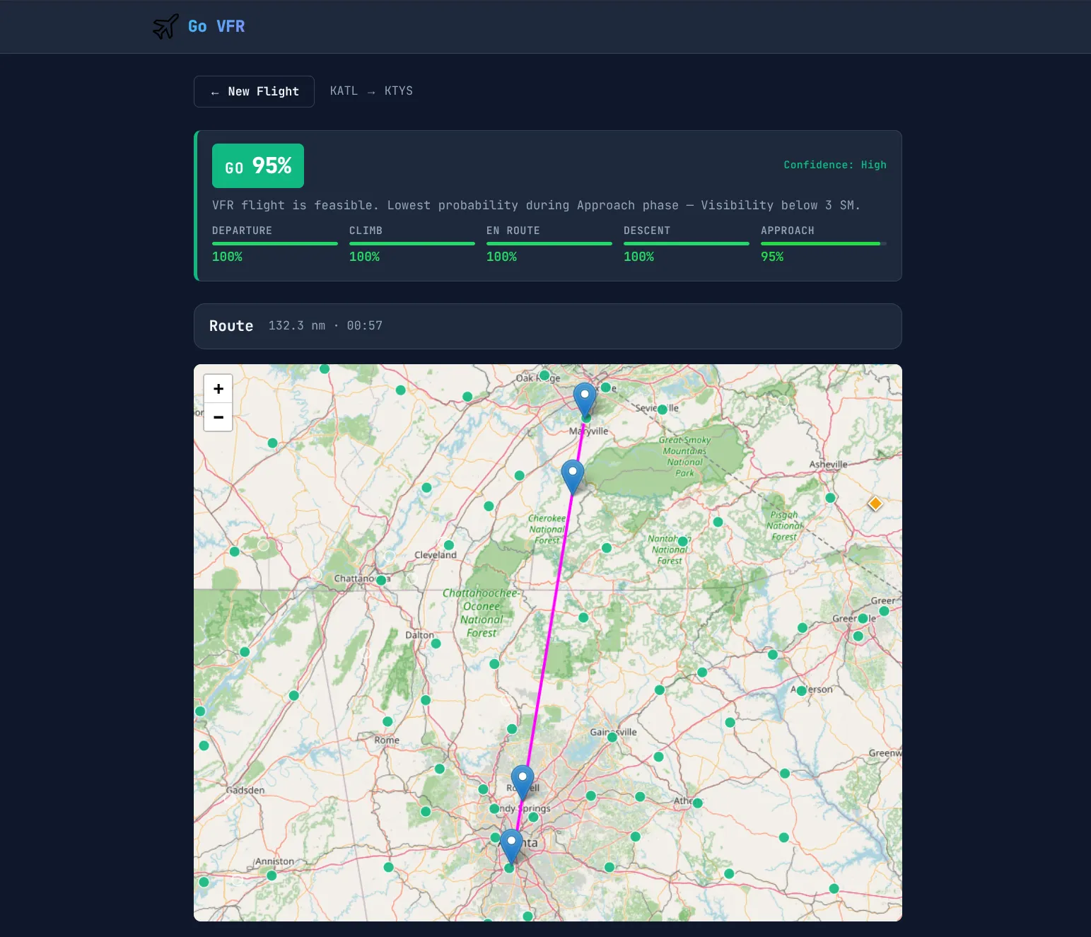
Route Assessment
Given a route and aircraft performance, Go VFR builds a route profile and nav log — breaking the trip into legs, applying forecast winds aloft to compute groundspeed and heading, and carrying a running ETA down the route.
Weather Along the Corridor
Rather than briefing only the airports directly underneath the route, Go VFR draws a corridor around the path and collects every relevant report inside it — METARs and TAFs from nearby stations, winds aloft fixes, PIREPs, and AIRMET/SIGMET polygons that intersect the corridor. Each item is tied back to the point on the route where you would actually encounter it.
ETA-Based Aggregation
Weather is not static, and neither is your position. As the nav log advances your ETA down the route, Go VFR aggregates the forecast data valid at that time for that location — so the conditions shown for a waypoint a couple hours out reflect the forecast for your arrival, not the current observation.
Filling Sparse Coverage
Station coverage thins out over remote terrain and aloft. Where forecasts are sparse, Go VFR estimates cloud layers and conditions by interpreting HRRR atmospheric model data into VFR-relevant ceilings and visibilities. This is the most experimental part of the tool — accuracy is moderate so far — but it is kept in because the idea is worth developing.
Forecast Uncertainty
Weather forecasts carry uncertainty. Go VFR runs Monte Carlo simulations — varying forecast inputs across many iterations — to estimate the probability of maintaining VFR along the route. This part is still a work in progress.
Tech Stack
- Svelte 5 — UI framework
- Leaflet — interactive route mapping
- Rust + WebAssembly — Monte Carlo simulation engine
- Near-native speed for running thousands of iterations in the browser
- Compiled to WASM so it runs client-side with no backend compute